Solar Farm near Pallet Hill: Site Assessment and Design
The solar farm will be developed south of Pallet Hill, in the Eden District. Following detailed technical analyses, this land allows us to build a project with the following technical characteristics:
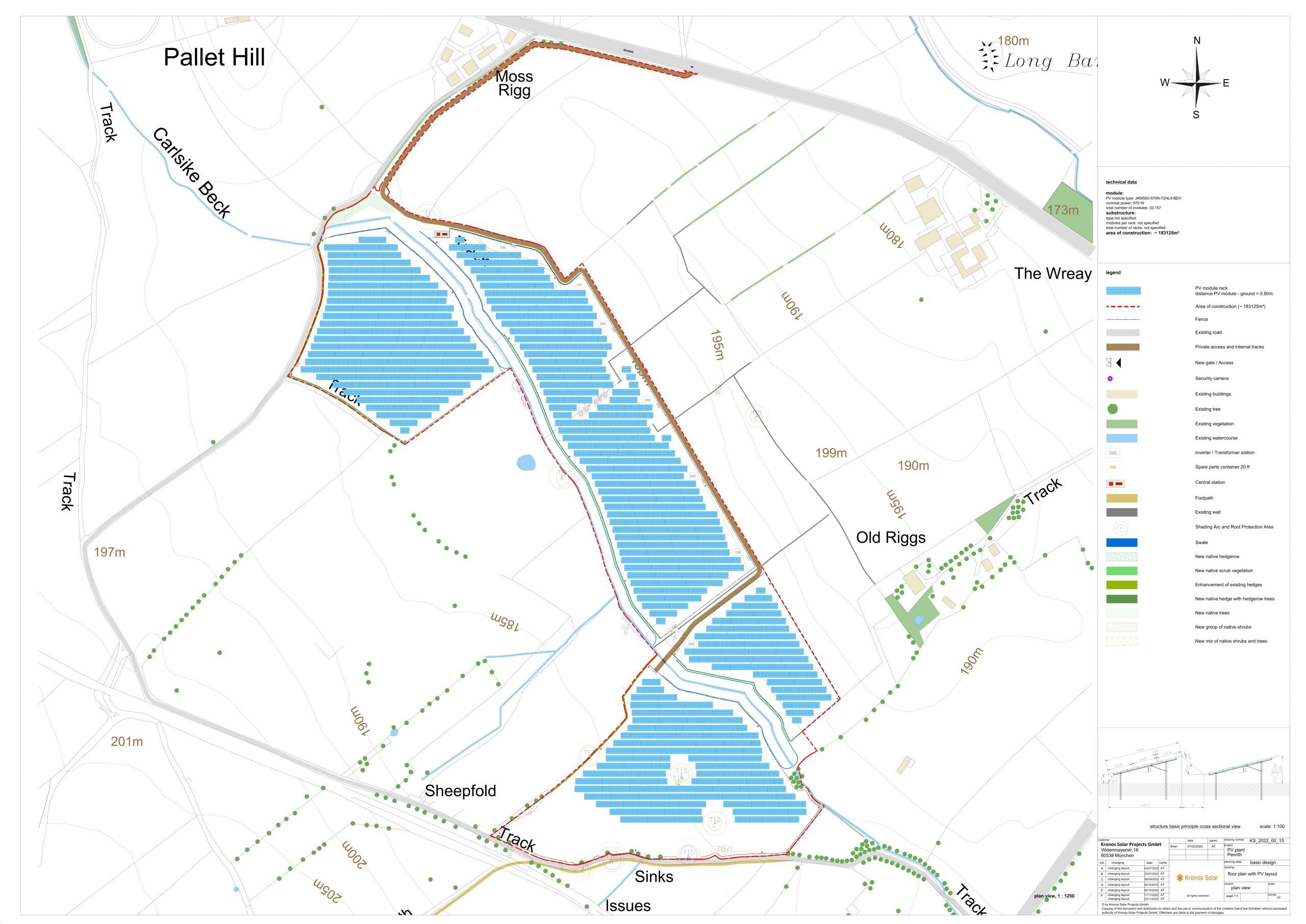
- Construction area: approx. 45 acres including the area where the substation is located
- Peak capacity: 20 Megawatt
- Clean energy supply for approximately 5,060 households.
- Avoidance of 14,000 tonnes of CO2 per year.
Layout of the solar farm
Landscape Integration
The starting point of the landscape integration plan is the preservation and strengthening of the existing landscape structures in the area. The following measures, among others, can be taken as part of the landscape integration plan:
- Retention of hedgerows and trees, as well as planting new ones along selected boundaries of the site for additional screening;
- Installation of a 2.10m deer fence to distinguish the boundaries of the site; and
- Enhancement of retained grassland around the solar panel infrastructure through over-seeding.
The reinforcement and planting of hedges offers many opportunities for local fauna including birds and insects, such as shelter and foraging areas. The fencing is necessary to prevent theft and destruction of the solar panels as much as possible and is a requirement of the solar farm’s insurance company.
Example of deer fence

Agricultural Land Classification
The great majority of the site has been assessed as Sub-Grade 3b agricultural land. This means it is not “best and most valuable land”, in other words, from a food production perspective, it is sub-optimal. Farmers on land like this have to work the land very hard using large amounts of fertilizers, herbicides and other chemicals. This is neither economically sustainable nor environmentally sustainable. There will always be a conflict between food security and energy security; this is why we at Kronos Solar avoid using “best and most valuable land”, wherever possible.
Cultural Heritage and Archaeology
There are no listed buildings or scheduled ancient monuments located within the site, and there are no Registered Parks and Gardens or Registered Historic Landscapes located within or immediately surrounding the site. There is a Site of Special Scientific Interest and several listed buildings in the wider locality but it has been considered that there would be little or no effect on them with the proposed mitigation measures.
Highways and Access
Access to the site is proposed through a new access road turning off the B5288 away from Pallet Hill. A secondary access will be available turning off the B5288 to an unnamed road where farm gate access is already available.
Flood Risk
Running through the site is the Carsike Beck Brook, even through the water course is present the total land is in Flood Risk Zone 1. As mitigation a sustainable drainage system called a swale will be put in place to act as a filer as well as a temporary storage facility.
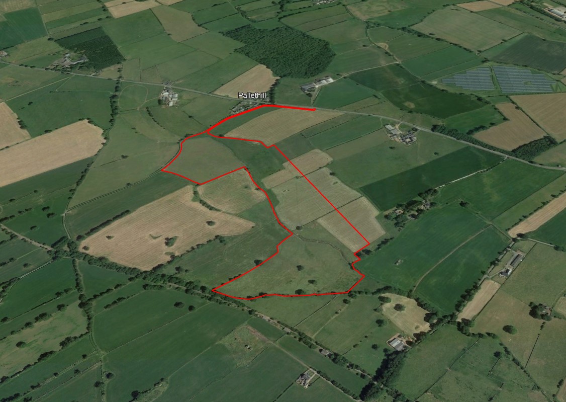
Aerial view of the location of the site
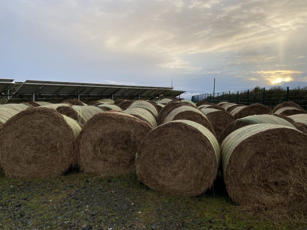
Land use combinations include grazing sheep and hay, and in some cases, honey bees. Below are some examples.
Ecology integration
The ecological considerations go hand in hand with the landscape mitigation proposals and include:
- Sensitive management of the retained hedges and trees for the benefit of the wildlife including targeted bolster planting;
- Conservation of trees of high value;
- Grassland management through an appropriate light grazing regime, such as sheep, and sensitive hay management;
- Provision of ground nesting habitat on areas removed from modules; and
- Provision of bat roosting and bird nesting boxes on suitable retained trees.